
GGGI Small Grant (2021) - Hawaii Pacific University Center for Marine Debris Research (USA)
ALDFG on coral reef - Rachel Sandquist, CMDR.
Project Summary
Building Evidence Toward Mitigation: Quantifying Hawaiian coastal reef damages of ghost gear sourced to particular fisheries
Abandoned, lost and discarded fishing gear (ALDFG) washes ashore by the tons in Hawai'i, threatening corals and other marine life. Hawai'i Pacific University’s Center for Marine Debris Research (CMDR) has been detecting and removing ALDFG from the environment to identify the sources and quantify the damage done to coral reef habitats. Partnering with Hawaiʻi Institute of Marine Biology, The Nature Conservancy, and Makanakai Marine Services, with funding from the Global Ghost Gear Initiative (GGGI), CMDR used Structure from Motion (SfM) high-resolution 3D imagery of a coral reef to capture imagery of coral in a high-risk DFG strike zone in Kāne'ohe Bay. The goal of the project was to capture imagery of the reef before a net strike, with the net on the reef, and the reef after the net was removed, in order to quantify the damage and recovery of the reef over time.
Baseline ‘before’ images were captured along two 10m-wide swaths of the coral ledge along the northeastern edges by Marker 12 in the northern end of Kāne'ohe Bay on the windward side of O'ahu, areas identified as high-probability ALDFG strike zones. Approximately 100,000 images were captured covering 3,250 square feet of coral reef over four days in the field. Fortunately, or unfortunately, no DFG struck that area of reef during the project period. However, the award did support ongoing marine debris surveys and the removal of 600 kg of marine debris from Kāne'ohe Bay. Additionally, an opportunistic small net strike occurred early in the project, however no images were captured at that site before the net strike to quantify damage and recovery of the reef. Even so, imagery captured with the net entangled on the reef and immediately after removal validated the ability of the SfM model to calculate volume differences through time.
In addition to supporting training, fieldwork, image processing, surveys, and removal of debris, the project produced scientific findings that can be used as evidence to quantify ALDFG in Hawai'i, while building capacity for mitigation programs to reduce ecological impacts. CMDR was also able to estimate the economic cost of ALDFG removal and disposal/recycling, and propose formalized mitigation or remediation programs that included repurposing collected ALDFG.
Short video of a 3D model of before and after ALDFG struck the reef.

In-water training at a one-day Structure from Motion training session given by the Madin lab at the University of Hawaiʻi’s Hawaiʻi Institute of Marine Biology (HIMB).

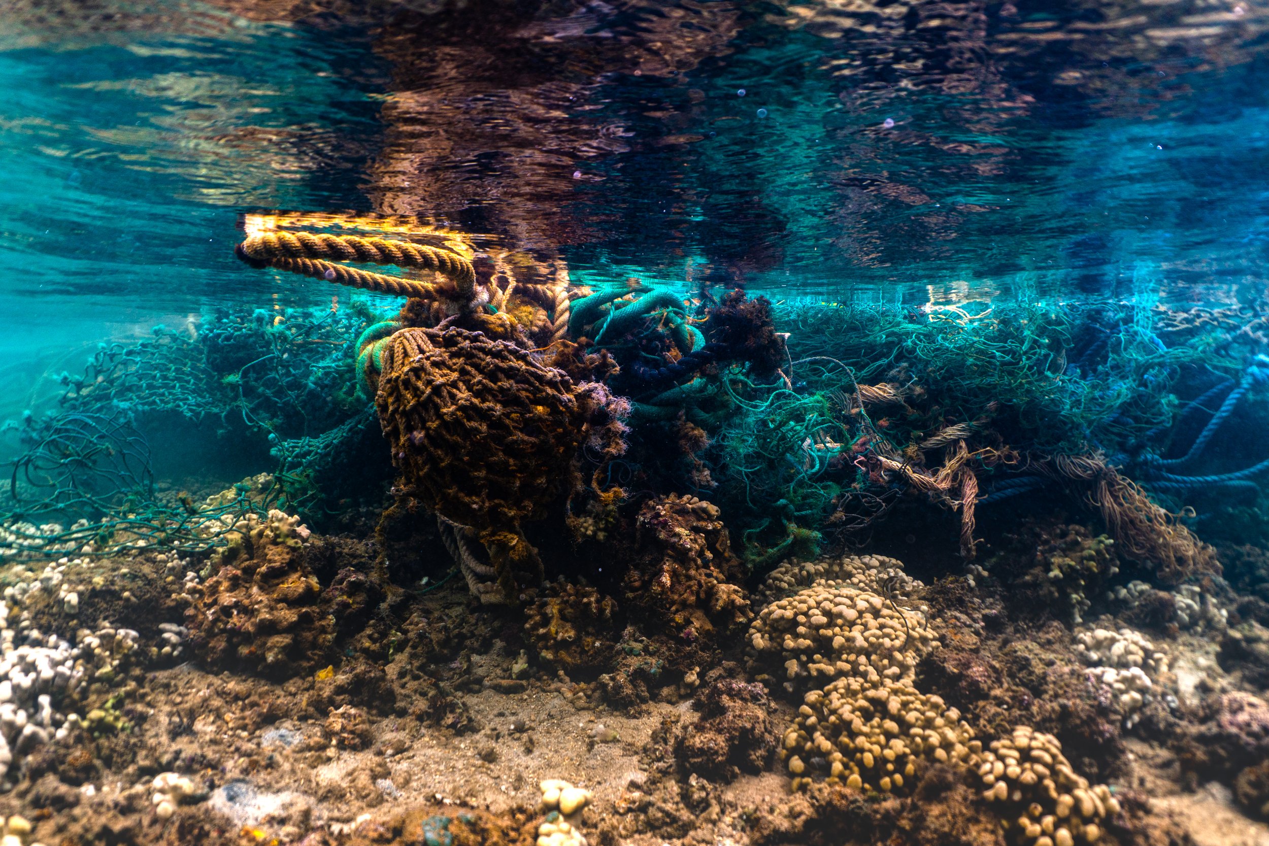
Opportunistic ALDFG conglomerate entangled on coral reef in Kāneʻohe Bay.
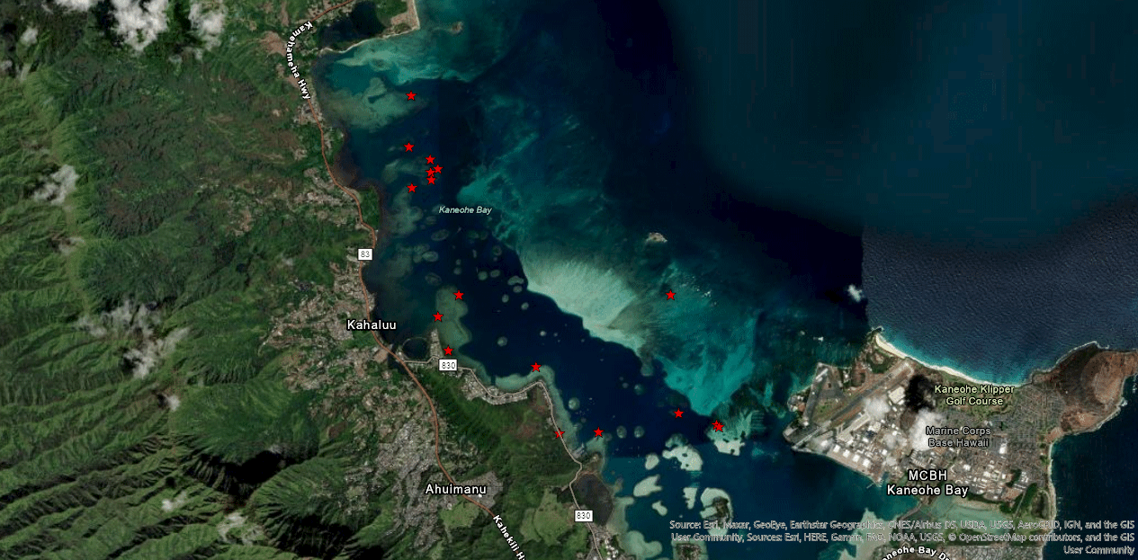
Map of Kāneʻohe Bay, Oʻahu, Hawaiʻi, showing derelict fishing gear strike areas (red stars).
3D model - Spencer Miller, University of Hawaiʻi’s Hawaiʻi Institute of Marine Biology (HIMB).
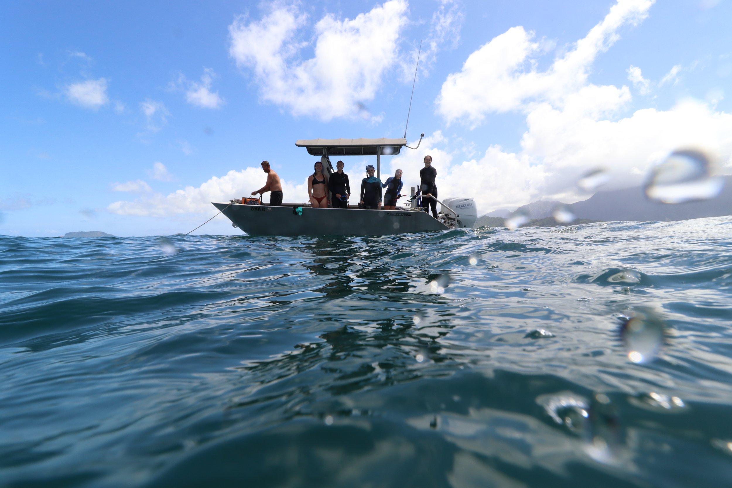
CMDR field team with boat captain Hank Lynch, The Nature Conservancy, doing fieldwork in Kane'ohe Bay.

Opportunistic ALDFG conglomerate entangled on coral reef in Kāneʻohe Bay.

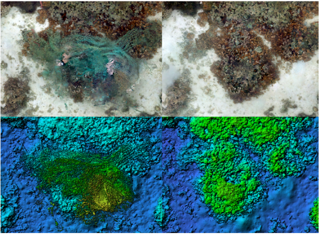
Orthomosaic of 841 m2 southeastern portion of the Marker 12 target area.

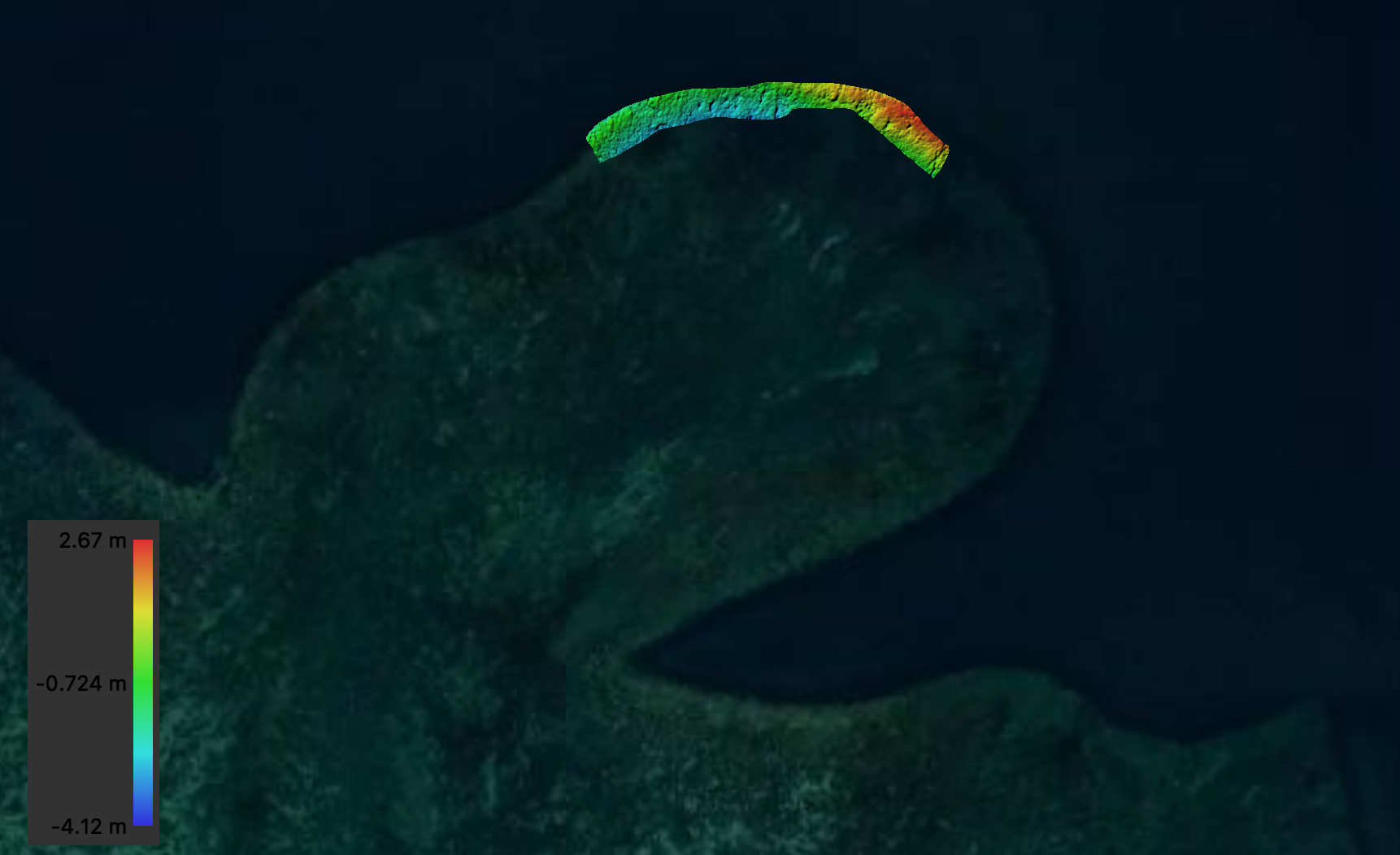
Digital Elevation Model (DEM) 841 m2 southeastern portion of the Marker 12 target area.

Zoomed-out orthomosaic of 841 m2 southeastern portion of the Marker 12 target area.
Zoomed-out Digital Elevation Model of 1063 m2 northern portion of the Marker 12 target area.