
GGGI Signature Project - Myanmar
Project Background
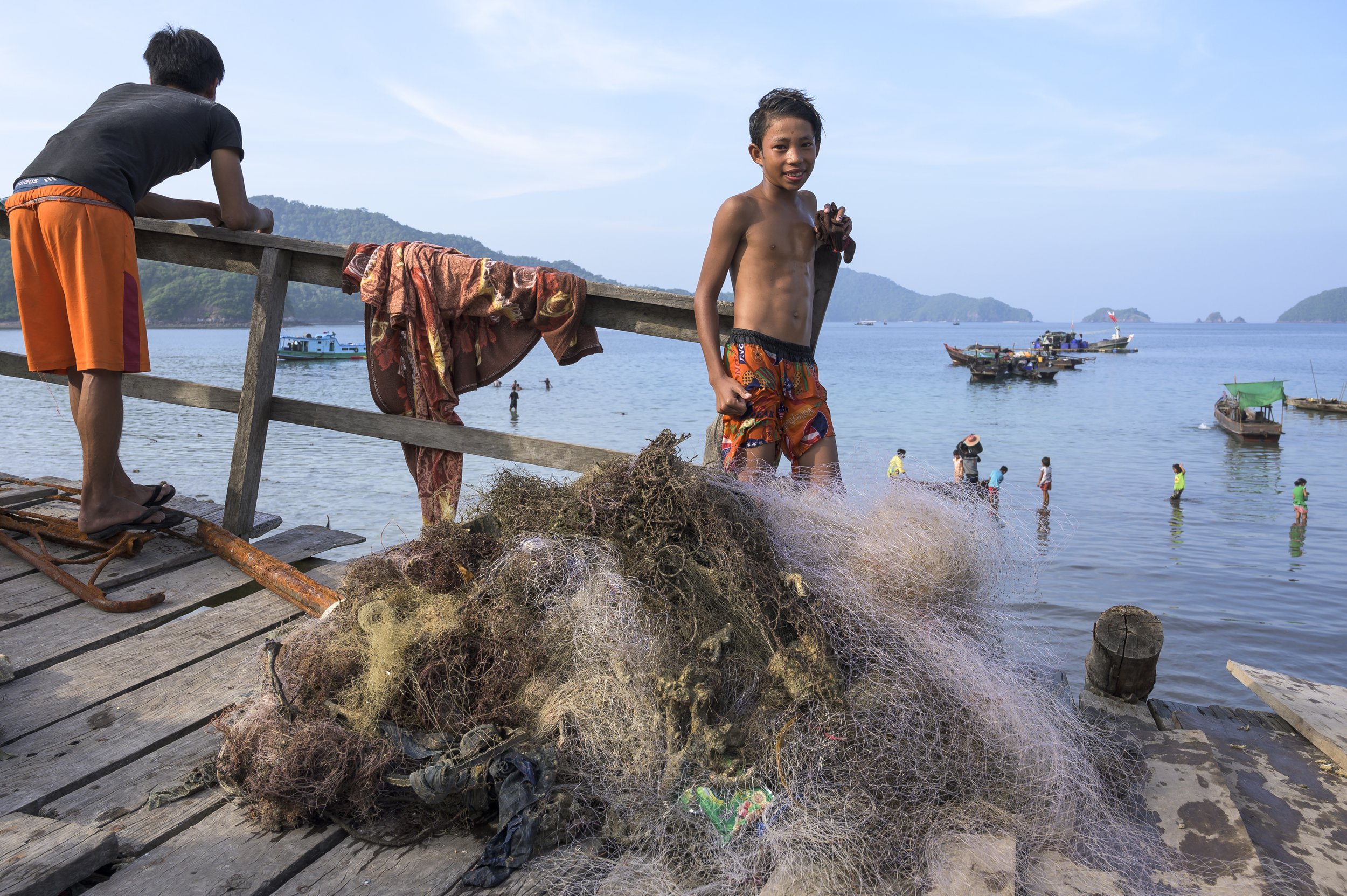
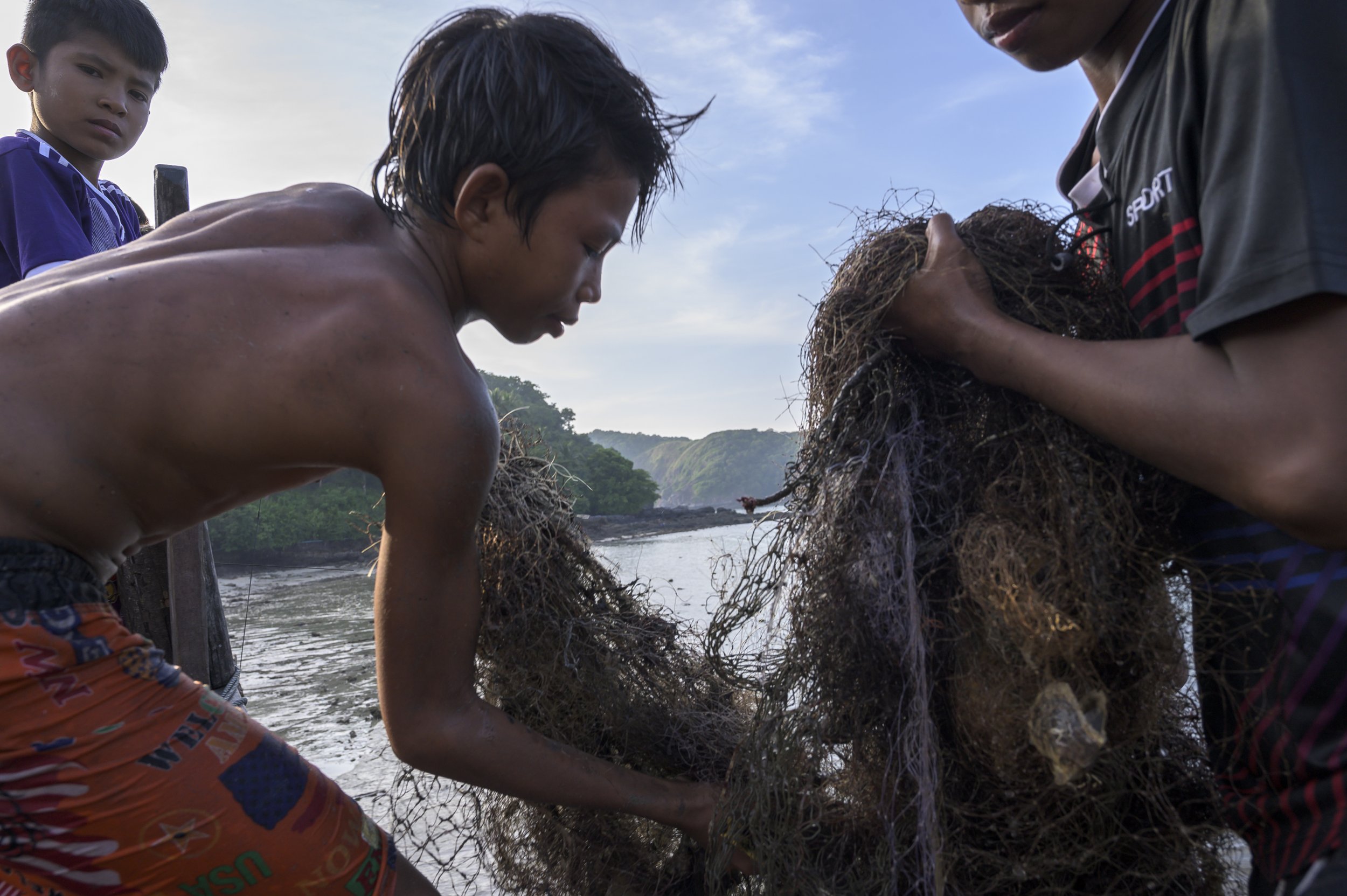
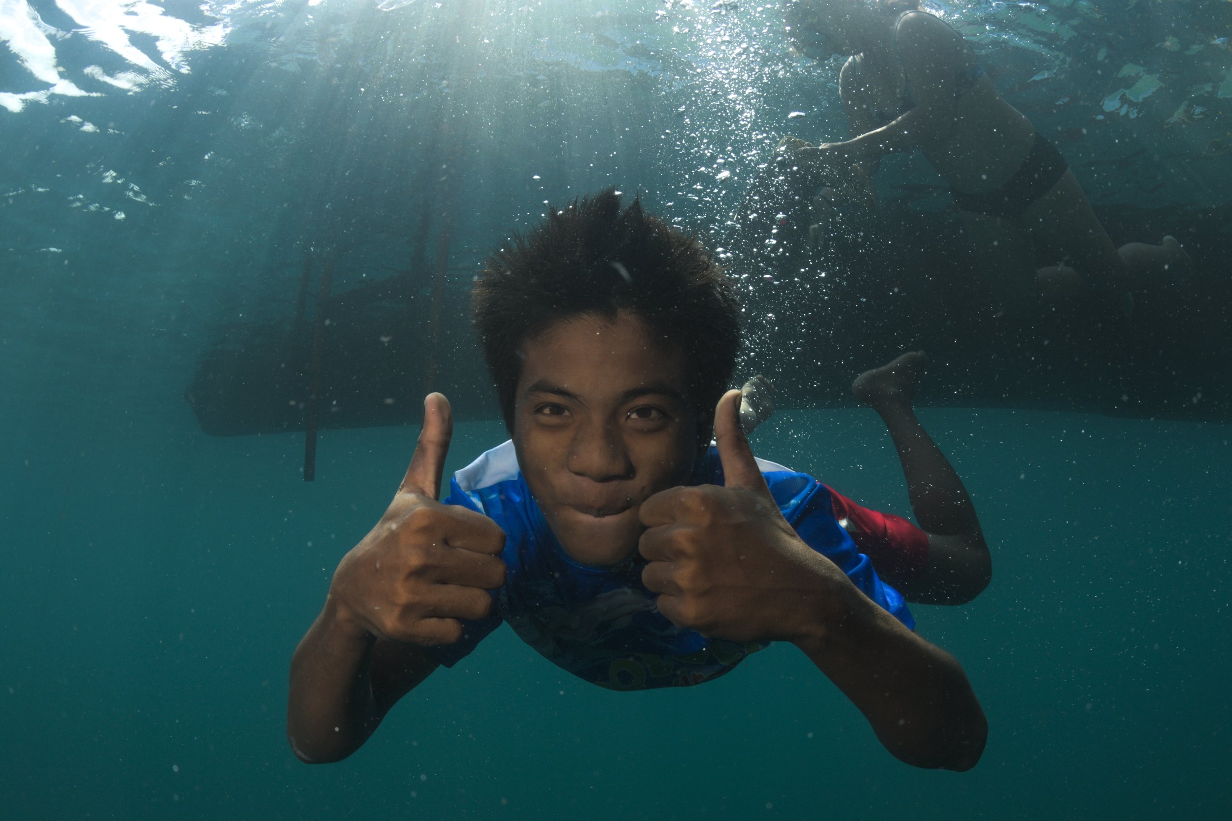
Lost, abandoned and discarded commercial and artisanal fishing gear is emerging as a critical threat to Myanmar’s coastal ocean, where it impacts both ecologically and economically important living marine resources, including threatened and endangered species like dugongs, turtles, manta rays, and corals; and poses a threat to Myanmar’s budding ocean-based tourism industry. To address the challenge of ghost fishing gear in Myanmar, the GGGI and the Myanmar Ocean Project initiated a ghost gear removal pilot effort - the first of its kind in Myanmar. The project, funded by World Animal Protection and the National Geographic Society, focused specifically on the Myeik Archipelago, one of the most untouched island groups in the world. Throughout the islands of the archipelago, ghost nets from artisanal fisheries have been found beneath the surface, threatening key species such as manta rays, and harming the marine ecosystem. Ms. Thanda Ko Gyi, a Burmese national, highly skilled SCUBA diver, and founder of the Myanmar Ocean Project, was the first person in Myanmar to both raise the alarm about lost fishing gear and take the initiative to remove it, serving as Field Manager for the project.
Lost gear threatens the integrity and functioning of marine ecosystems. It continues to catch harvestable species, thereby impacting artisanal fishers; it drowns marine mammals, turtles, and birds, and kills sharks, rays, and fish. As well, lost fishing gear smothers seafloor and reef habitats, killing coral and altering local biodiversity. Furthermore, lost fishing gear impacts people, especially two key constituencies in southern Myanmar: artisanal fishermen and SCUBA divers.
Project Objectives
Conduct systematic underwater surveys for lost gear in order to conduct a preliminary quantitative assessment of the scope of the problem;
Draft a policies and procedures manual, utilizing previously developed manuals and best practices recommendations from the GGGI;
Identify and train highly skilled and experienced SCUBA divers to engage in safe and effective gear recovery, utilizing established methods;
Use the GGGI Ghost Gear Reporter app developed by the GGGI Build Evidence Working Group to collect and collate data on reported, observed and/or recovered gear;
Conduct outreach to local fishing communities, SCUBA diving groups, tourism operators and media outlets to raise awareness about the project; and
Recover ghost gear from the Myeik Archipelago.


Project Summary
(2019)
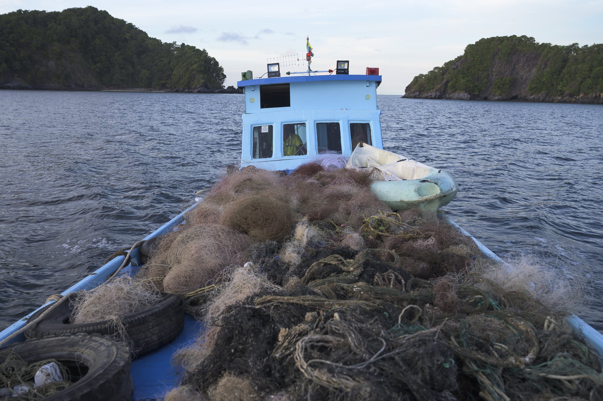
Phase one of the scoping and removal work was completed in March 2019 with phase two of the field work occurring in late 2019 with trips focused on three key sites in the Myeik Archipelago: Langann Island, High Rock and Lampi Island. Though the islands of the archipelago are largely untouched by humans, ghost nets from artisanal fisheries have been found beneath the surface, threatening key species such as manta rays, and harming the marine ecosystem.
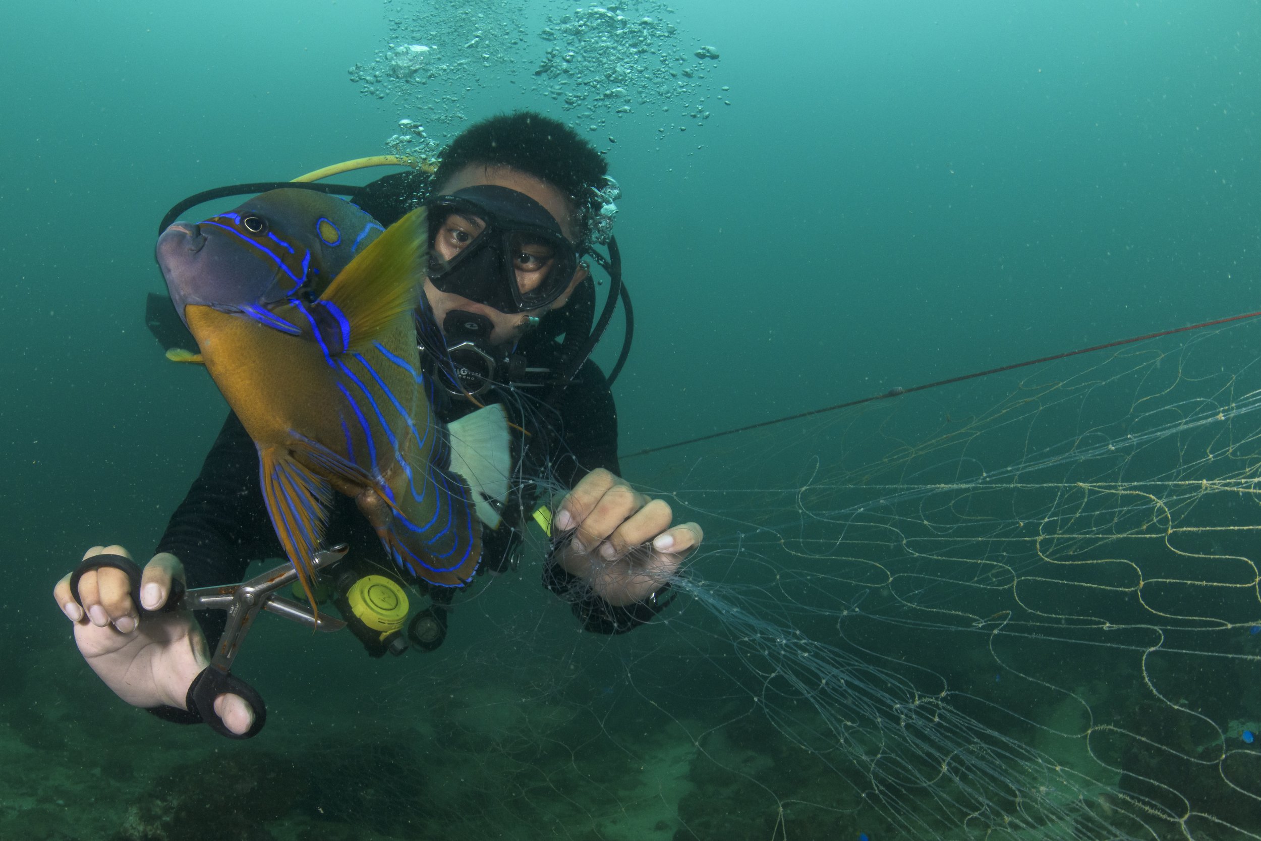
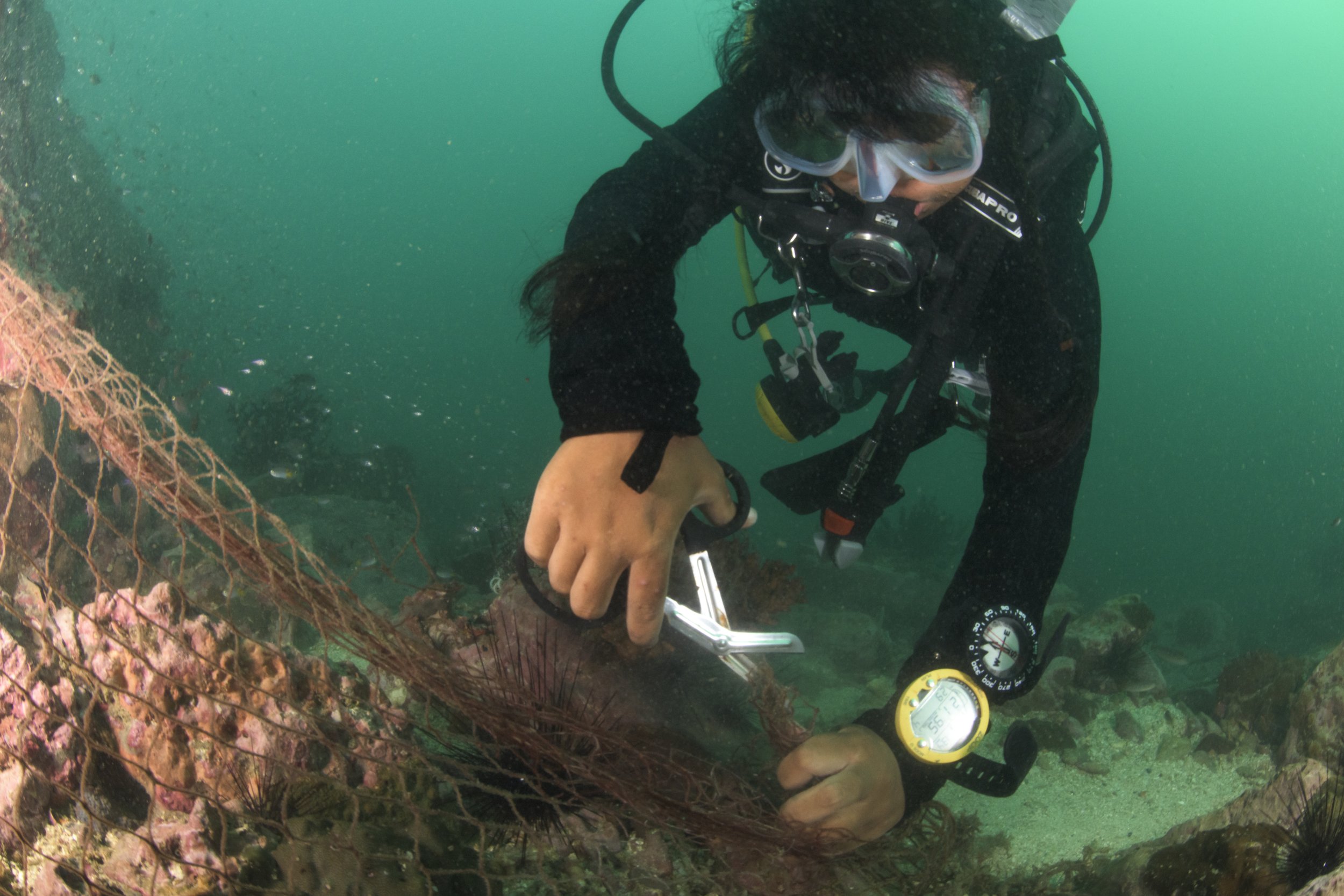
Methods for recovering lost, abandoned and discarded gear have been well worked out by groups engaged in similar efforts in other parts of the world. Generally speaking, lost gear is located through reports from fishers, divers, researchers or other ocean users in and on the water, or by sonar surveys of areas where gear is known to be lost. Gear is recovered by SCUBA divers utilizing tanks or surface-supplied air, who use cutting instrument and float bags to lift retrieved gear to the ocean surface where it is winched on board for disposal or recycling. This project team also collected data on the quantity, type and location of ghost fishing gear in a part of the world for which these data were previously absent, providing evidence (e.g. data, images, maps) for the impact that ghost fishing gear has on keystone species for this coral reef ecosystem, as well as on impacts to the corals themselves.
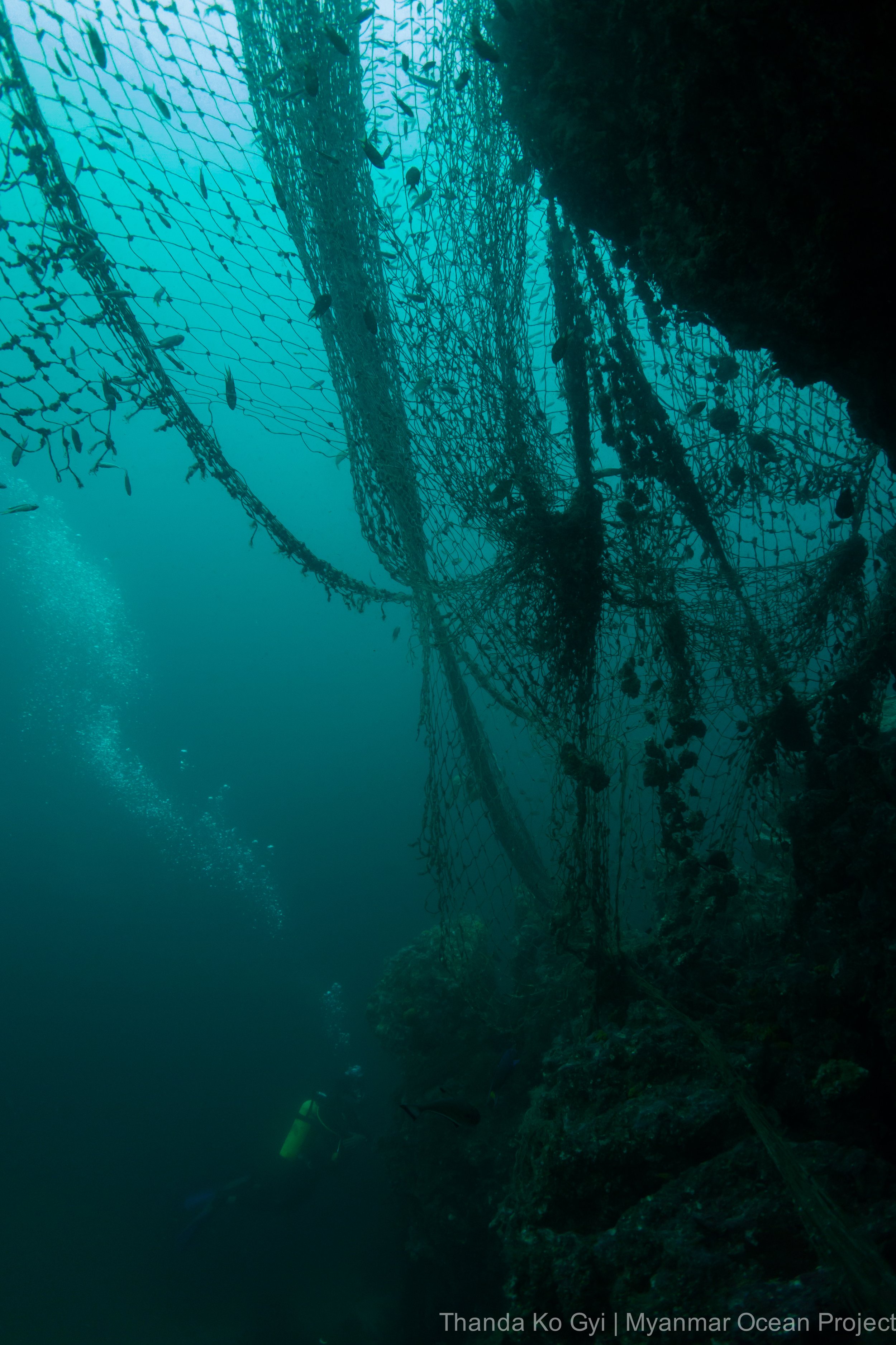
In Langann, the lost net problem is massive. The team found a plethora of nets on the sea floor and coral reefs in the area, mostly monofilament gillnet. As this is an area of high artisanal fishing activity and a popular place for vessels to come to get supplies, mainly ice and water, it was expected that the concentration would be high compared to other areas. However, nothing prepared the team for the extent of what they found. The team removed 527 kg over 4 days of dives, but there is still a vast amount of lost net to be recovered. Fortunately, local artisanal fishers on the island were engaged in the project and eager to help, so there’s hope for this area of incredible biodiversity.
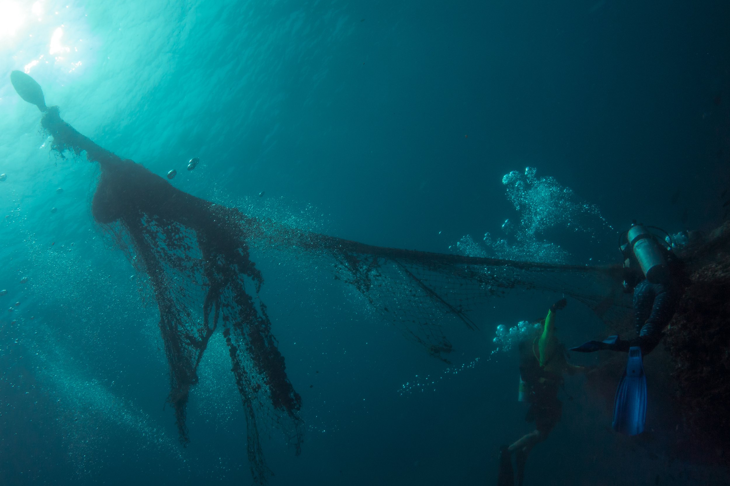
High Rock is an area with numerous rock pinnacles that is popular with dive tour operators. The team focused on one particular spire where they found at least four separate layers of net covering the rock, indicating at least 4 distinct major snag events. This time the net appeared to be purse seine net rather than gillnets. The strong currents and deep water in the area hindered removal efforts somewhat, but the team managed to recover 348 kg of net from the spire over nine dives across two days. However, there remains a significant amount of net to be removed.
The area around Lampi Island was actually remarkably free from nets, most likely due to the fact that the area has been designated as a national park since 1995. Although this was certainly encouraging, once the team left the marine park boundaries, there was a correspondingly high concentration of lost gillnets and the team removed 139 kg over a day and a half of diving.
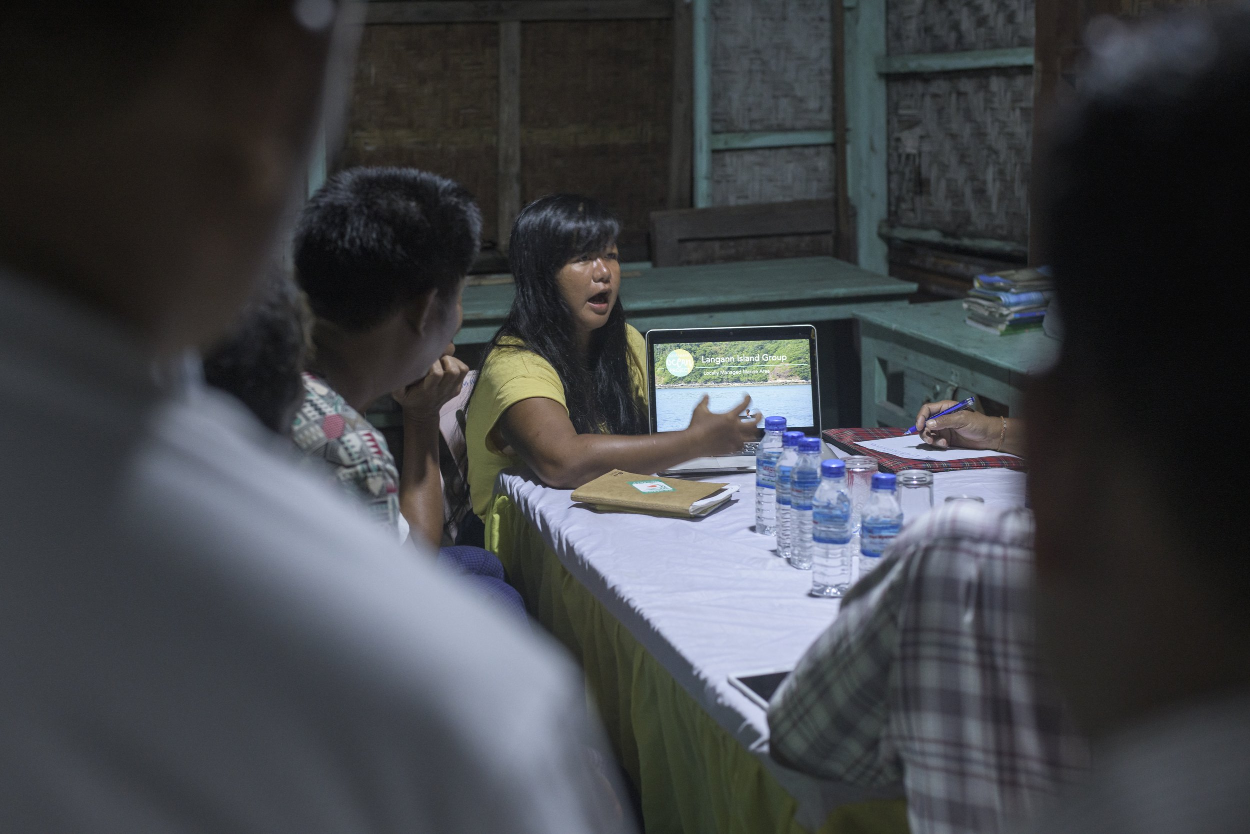
Although there is certainly a major problem with lost and abandoned fishing gear in the Myeik Archipelago, it’s encouraging that local artisanal fishers are being educated on this issue by the Myanmar Ocean Project team and are generally keen to help. As this problem occurs for the most part beneath the surface of the water, most fishers were unaware of the extent of the impacts of lost gear on the local species and their own livelihoods, and were eager to engage our team and find ways to help mitigate the problem.
While this work was going on, the GGGI and Myanmar Ocean Project partnered with Dr. Sol Milne from the University of Aberdeen in the UK to test the use of unoccupied aerial vehicles (UAVs) for detecting ALDFG in nearshore coastal environments. Over the course of the surveys, Dr. Milne collected approximately 10,000 images of the various islands surveyed in the Myeik Archipelago, which were analyzed to detect instances of ghost gear either at or just under the surface (down to ~11 metres). An initial report was produced in 2020, and although the process proved highly successful and we were able to detect gear with a high degree of accuracy, it required a significant amount of time to manually analyze each image to find lost gear. With support from Schmidt Marine Technology, began developing a machine learning algorithm to detect gear in these images, which can be used for future survey work for ALDFG in similar locations. This will increase the area that can be effectively scanned and greatly reduce the cost to analyze the imagery. Initial results of this work were completed in 2021, and showed a significant reduction in the overall time required to identify ALDFG from aerial imagery. We’ve since continued this methodology to further train the AI model in several countries as part of our GGGI Signature Project in the Caribbean, and Dr. Milne, through his company Wolf Fish Ltd., has conducted other surveys in Greece and Thailand.


Project partners
Partners
University of Aberdeen
Funders
National Geographic Society
World Animal Protection